Taman Negara(Gunung Tahan)
Taman negara(national park) is best known and famous with its natural tropical rainforest. Gunung Tahan is located in Taman negara. You may enjoy and close to the natural here.
Gunung Tahan, located within Taman Negara National Park in Pahang, is West Malaysia's highest mountain. The climb to the summit is very tough due to the undulating nature of the 55km trail. In all, the actual climb is 3,800m to reach the summit of the 2,187m mountain which will normally take five days.
The adventure to conquer Tahan's summit starts from the park headquarters (Park HQ) at Taman Negara Resort. Along the way there are numerous open clearings where campsite can be set for the night.
Five of the campsites -- Melantai, Puteh, Teku, Wray's Camp and Padang -- have water points nearby. They are therefore ideal for overnight camping.
Hikker must know before trail
- The itineraries for the various packages for Gunong Tahan and waterfalls are subject to change without prior notice. The price quoted are for group size from 8 - 12 persons. Rates will vary if below 8 persons or above 12 persons. The ruling is that 1 guide can only take 12 paxs at any one time. Climbers are required to buy at own cost personal accident insurance for the duration of the climb
- Entry and camping permits from The Department of Wildlife and National Parks at the resort. Also a permit for a camera is required.
- Guide Requirement : The rule is one guide for every group of up to 12 people included in the package rate below.
- Rate Per Person RM 480.00 nett
- Package includes : Transfers, permit fees, guide fees and camping fees
- Excludes : Equipments, camera fees and food
Get your Itinerary here
- 1. The Summit Trail Itinerary Park HQ To Melantai
Commenece the journey after lunch at Taman Negara Resort, and should reach the Melantai campsite before nightfall.
- 2. Melantai To Puteh
The trail to Puteh involves a tiring trek up and down a series of 27 hills.
- 3. Puteh To Teku
The Tahan River will be crossed seven times on the way to Teku. Use a branch as a walking stick to help in crossing the river. Avoid the rocks as they are slippery. If the water level is high after a downpour, there is a longer detour to avoid the river.
- 4. Teku To Wray's Camp
From Teku it is a gruelling four-hour uphill climb to Wray's Camp. During this stretch, the climb will be from 168m to 1,100m. Do take time to enjoy the scenery while climbing. Along the route tiny pitcher plants and butterflies can be found on the trek.
- 5. Wray's Camp To Padang
Look out for a massive rock resembling camel humps. There is also a steep sheltered gully, beautiful when water trickles down the rock face after a rain. These two spots make popular backdrops for souvenir photos.
- 6. Padang To The Summit
From Padang, most people make their way up to the summit and then down again in a day as Padang, with its wide open ground, is a more comfortable campsite than the peak. Start early and travel light bringing only water, food and a raincoat. Be sure to start the return trek by 2pm so that trekkers can reach Padang before nightfall.
The Trek back to Kuala Tahan takes 2 or three days
Tips
- Bring T-shirts, shorts, thick socks, windbreaker or sweater, slippers, raincoat, 1.25-litre plastic water bottles, insect repellent spray, torch, sleeping bag, talcum power.
- Bring an extra pair of shoes for longer trips. Pack clothing in plastic bags to avoid getting wet.
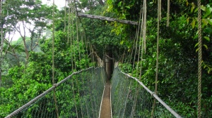
- Taman Negara Canopy walk is the world's longest walk hanging in the air. It winds over 400 meters, 25 meters above the ground in the forest canopy allowing you to view the rich and diverse flora and fauna.
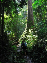
- Jungle treks
- Photgraph
- Play around at waterfall
Blog: Climb West Malaysia Highest Mountain - Gunung Tahan Pahang
